Do You Know What Is A Hurricane, Typhoon Or Cyclone?

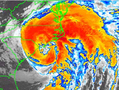
In the US, very powerful storms called hurricanes threaten the eastern and gulf coasts of the United States, Mexico, Central America and the Caribbea every year between June and November. In other parts of the world, they may be called typhoons or cyclones. When these hurricanes make landfall, they can wreck serious havoc and kill thousands of people and cause billions of dollars of property damage if they managed to reach densely populated areas.
The National Hurricane Center defines "hurricane" as a name for a tropical cyclone that occurs in the Atlantic Ocean. "Tropical cyclone" is the generic term used for low-pressure systems that develop in the tropics. Tropical cyclones with maximum sustained surface winds of less than 17 meters per second (39 mph / 62.7 kph / 34 knots) are called tropical depressions. Once the tropical cyclone reaches winds of at least 17 m/s, it is typically called a tropical storm and assigned a name. If winds reach 33 m/s (74 mph / 119 kph / 64 kt), then it is called a "hurricane."
How does a hurricane form?
Hurricanes form in tropical regions where there is warm water (at least 80 degrees Fahrenheit / 27 degrees Celsius), moist air and converging equatorial winds. Most Atlantic hurricanes begin off the west coast of Africa, starting as thunderstorms that move out over the warm, tropical ocean waters. A thunderstorm reaches hurricane status in three stages:
* Tropical depression - swirling clouds and rain with wind speeds of less than 38 mph (61.15 kph / 33 kt)
* Tropical storm - wind speeds of 39 to 73 mph (54.7 to 117.5 kph / 34 to 63 kt)
* Hurricane - wind speeds greater than 74 mph (119 kph / 64 kt)
It can take anywhere from hours to several days for a thunderstorm to develop into a hurricane. Although the whole process of hurricane formation is not entirely understood, three events must happen for hurricanes to form:
* A continuing evaporation-condensation cycle of warm, humid ocean air
* Patterns of wind characterized by converging winds at the surface and strong, uniform-speed winds at higher altitudes
* A difference in air pressure (pressure gradient) between the surface and high altitude
Warm, moist air from the ocean surface begins to rise rapidly. As this warm air rises, its water vapor condenses to form storm clouds and droplets of rain. The condensation releases heat called latent heat of condensation. This latent heat warms the cool air aloft, thereby causing it to rise. This rising air is replaced by more warm, humid air from the ocean below. This cycle continues, drawing more warm, moist air into the developing storm and continuously moving heat from the surface to the atmosphere. This exchange of heat from the surface creates a pattern of wind that circulates around a center. This circulation is similar to that of water going down a drain.
"Converging winds" are winds moving in different directions that run into each other. Converging winds at the surface collide and push warm, moist air upward. This rising air reinforces the air that is already rising from the surface, so the circulation and wind speeds of the storm increase. In the meantime, strong winds blowing at uniform speeds at higher altitudes (up to 30,000 ft / 9,000 m) help to remove the rising hot air from the storm's center, maintaining a continual movement of warm air from the surface and keeping the storm organized. If the high-altitude winds do not blow at the same speed at all levels -- if wind shears are present -- the storm loses organization and weakens.
High-pressure air in the upper atmosphere (above 30,000 ft / 9,000 m) over the storm's center also removes heat from the rising air, further driving the air cycle and the hurricane's growth. As high-pressure air is sucked into the low-pressure center of the storm, wind speeds increase.
Once a hurricane forms, it has three main parts:
* Eye - the low pressure, calm center of circulation
* Eye wall - area around the eye with the fastest, most violent winds
* Rain bands - bands of thunderstorms circulating outward from the eye that are part of the evaporation/condensation cycle that feeds the storm.
Hurricane damages:
Hurricane brings with it huge amounts of rain, flooding the area that it crosses. High sustained winds also cause structural damage. These winds can roll cars, blow over trees and erode beaches (both by blowing sand and by blowing the waves into the beach). The prevailing winds of a hurricane can push a wall of water, called a storm surge, in front of it. If the storm surge happens to synchronize with a high tide, it causes beach erosion and significant inland flooding. Hurricane also creates smaller tornados which are concentrated cyclones and they will cause more damages.


0 Comments:
Post a Comment
<< Home